GPS: How Does It Know Where I Am?
Phil Kesten
Do you look around the natural world and wonder? Wonder why things work the way they do, why things are the way they are? If you do, then there’s a bit of physicist inside of you! Physics is all around us.
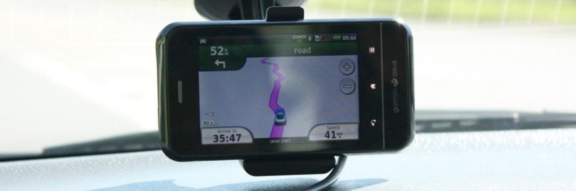
Let’s wonder together about the Global Position System (GPS). GPS has become ubiquitous. Phones, tablets, laptops, even cameras, have built-in GPS software. But how does it work?
First, I’ll tell you something about where I am, and we’ll try to pinpoint my location.
I am 188 miles from Reno, Nevada. I’m certainly not in, say, Boston or Chicago. But I could be in Santa Clara, which is 188 miles from Reno, or in Fresno, CA, also 188 miles from Reno. In fact, I could be any place on a circle of radius 188 miles that is centered on Reno, NV.
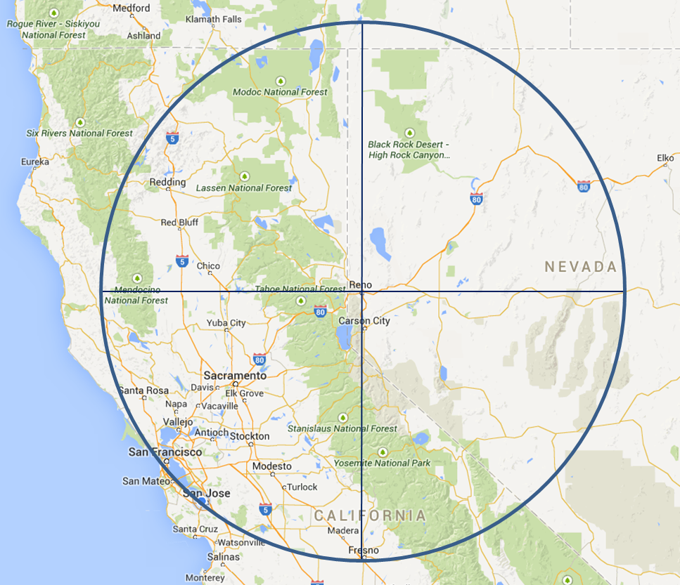
I am 188 miles from Reno, Nevada.
I am also 83 miles from Davis, CA. Yes, this also describes a circle, but that circle and the circle centered on Reno cross in only two places: Santa Clara and the little town of Hopland in Northern California. That is, both Santa Clara and Hopland are 83 miles from Davis. I must be in one of these two places, although we can’t tell which.
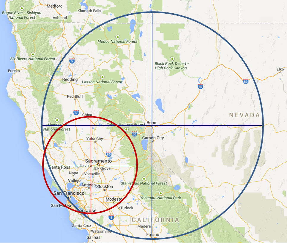
I am also 83 miles from Davis, CA.
I am also 54 miles from Modesto, CA. Again, this describes a circle of possible locations. But there is only location that is 54 miles from Modesto, 83 miles from Davis, and 188 miles from Reno: Santa Clara!
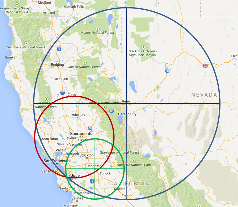
I am also 54 miles from Modesto, CA
Using three distances, or equivalently, three circles, we are able to pinpoint my location on Earth.
We could leave it at that – the distance from three different places defines a precise location. But suppose we want to determine the elevation of hikers on a mountain, or perhaps the altitude of an airplane. Our three-circle method doesn’t take height into account.
I am 188 miles from Reno, NV. I could by flying in an airplane a few miles directly above San Francisco – that would put me 188 miles along a straight line from Reno. But that location is not on the Davis or Modesto circles. We need more information to find my location.
The fix is simple. Instead of drawing circles around each known location, draw spheres. The Reno and Davis spheres have a circle’s worth of points in common. As we’ve seen, two more distances are needed to narrow my location down from a circle of possibilities. So get the distances from Modesto and one other location, and we’ve done it.
Four distances, from four known locations, and we can pinpoint any position on or above Earth’s surface. It doesn’t matter which four reference locations we use.
Four distances, from four known locations, and we can pinpoint any position on or above Earth’s surface. It doesn’t matter which four reference locations we use.
A GPS receiver, then, needs to determine the distance to four known locations. Those locations must be in view of the receiver, so that the distances can be determined quickly. Because they can be seen from far away, satellites are the best choice for known locations.
In order to guarantee that there are always at least four satellites above the horizon, the GPS system employs a “constellation” of thirty satellites. Here is a map showing the current position of all GPS satellites. Each satellite orbits Earth twice a day at an altitude of about 12,500 miles. The specific orbits were selected to insure that any GPS receiver – like the map application on your smartphone – will always be able to communicate with at least four satellites.
Each GPS satellite sends out its exact location in space, along with the precise time the signal was sent. Because the speed at which the signal travels is known – it’s the speed of light – a GPS receiver can determine the distance to the satellite from the time delay between when the satellite sent the signal and when the signal was received.
To enable a GPS receiver to determine its location accurately, the atomic clock on each satellite needs to keep time correct to within twenty to thirty billionths of a second. But as we learned from wondering about the movie Interstellar, the rate at which a clock ticks depends on the strength of gravity and also the clock’s motion relative to another.
The GPS satellites travel at high speed around Earth, and are much farther from Earth’s center than any GPS receiver. That means their clocks don’t run at the same rate as, say, a clock on Earth! According to Einstein’s theory of relativity, the clock on a satellite will gain thirty-eight millionths of a second every day, compared to a clock on Earth’s surface. If we didn’t correct for that discrepancy, our navigation systems would be off by many miles after just one day. And you thought relativity was only for physicists and movies!
Four satellites, four distances, a quick calculation. GPS knows where you are.
---------------------------------------------------------
Questions to ponder:
Does the GPS system really know where you are? If you lost your smartphone, could the GPS system find it for you?
Navigation systems in cars sometimes have trouble getting a fix on your position when you’re driving in the downtown area of a big city, say, Los Angeles or New York. What might cause that?
Nov 9, 2015