Our Motivation
Smallholder coffee farmers in Northern Nicaragua and throughout Central America are threatened by climate change, thus obstructing global progress toward poverty alleviation, food and water security, and sustainable development (Lipper et al., 2014; Vermeulen et al., 2017). Our partnership between CII-Asdenic, a local development NGO, and university collaborators is using surveys, focus groups, and community-based mapping to learn about smallholders' water resources, water governance, and their experiences and perceptions of water security and preparedness for extreme rains and droughts more likely under climatic changes in the region. The goals of our work include supporting strategies towards greater water security and climate resilience for local communities, including locally-led adaptation and mitigation strategies.
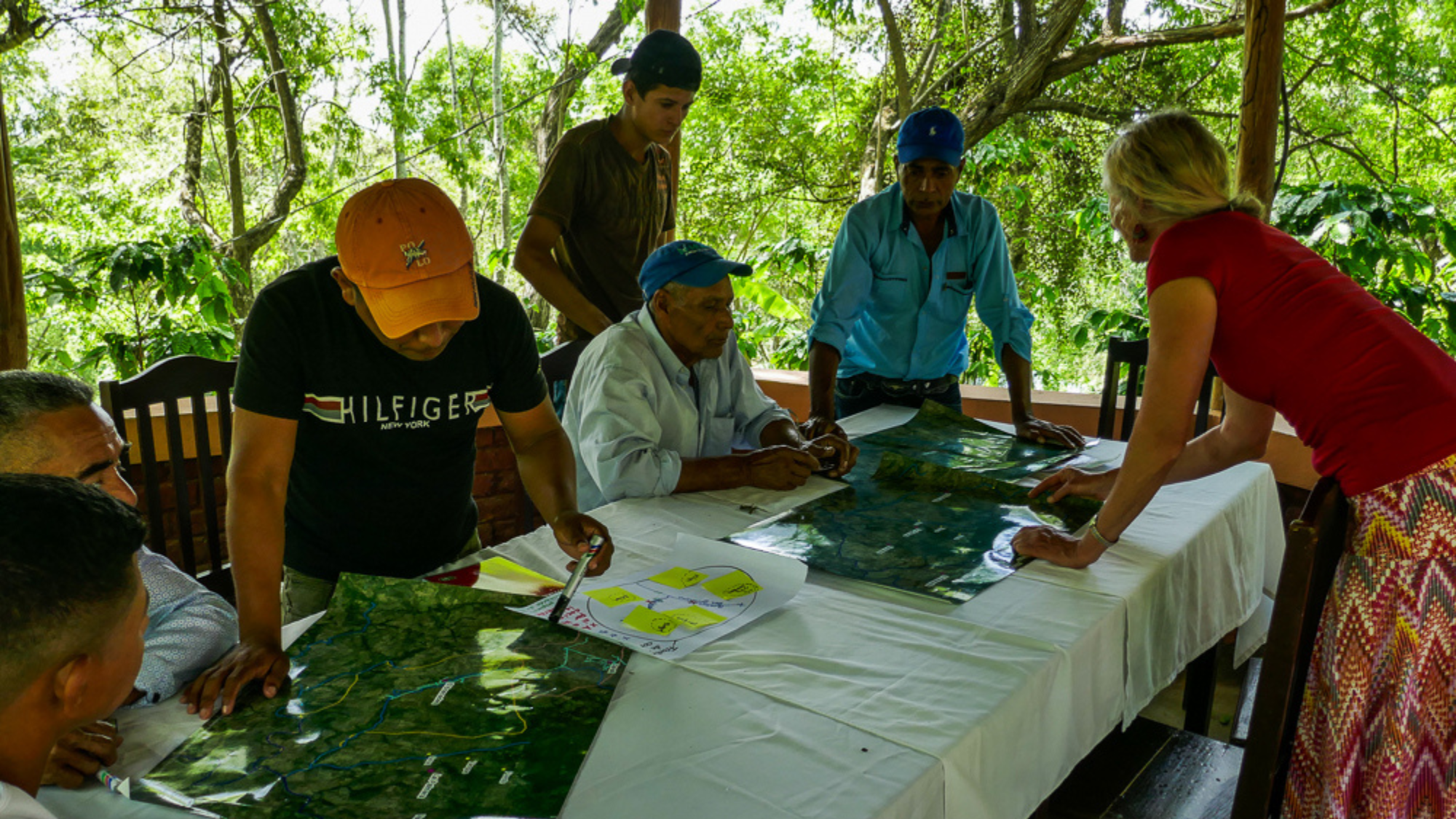
Mapping of community resources. Esteli Workshop, June 2019
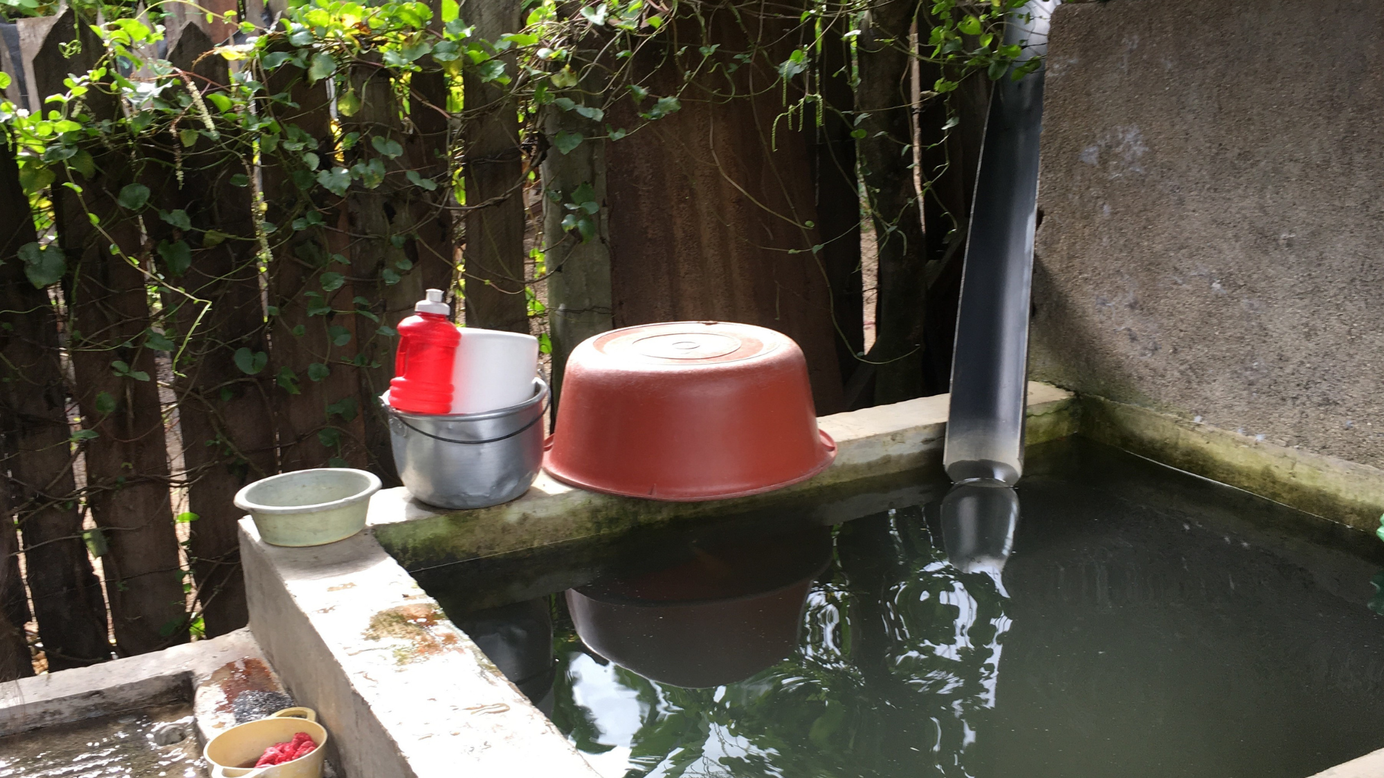
Collection of rainwater for washing and cleaning
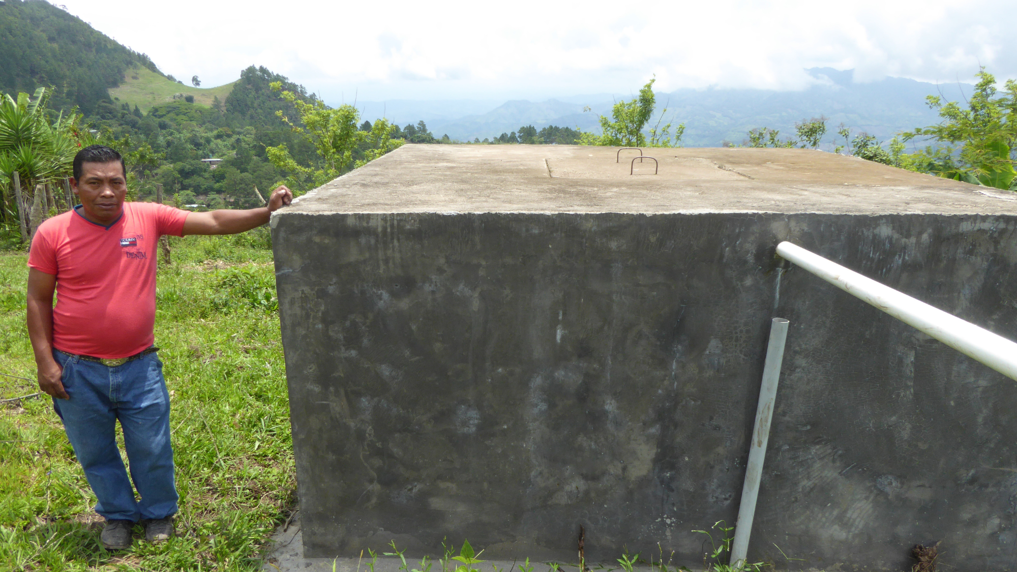
Water supplies are captured in tanks and distributed to the communities
Mapping of community resources. Esteli Workshop, June 2019
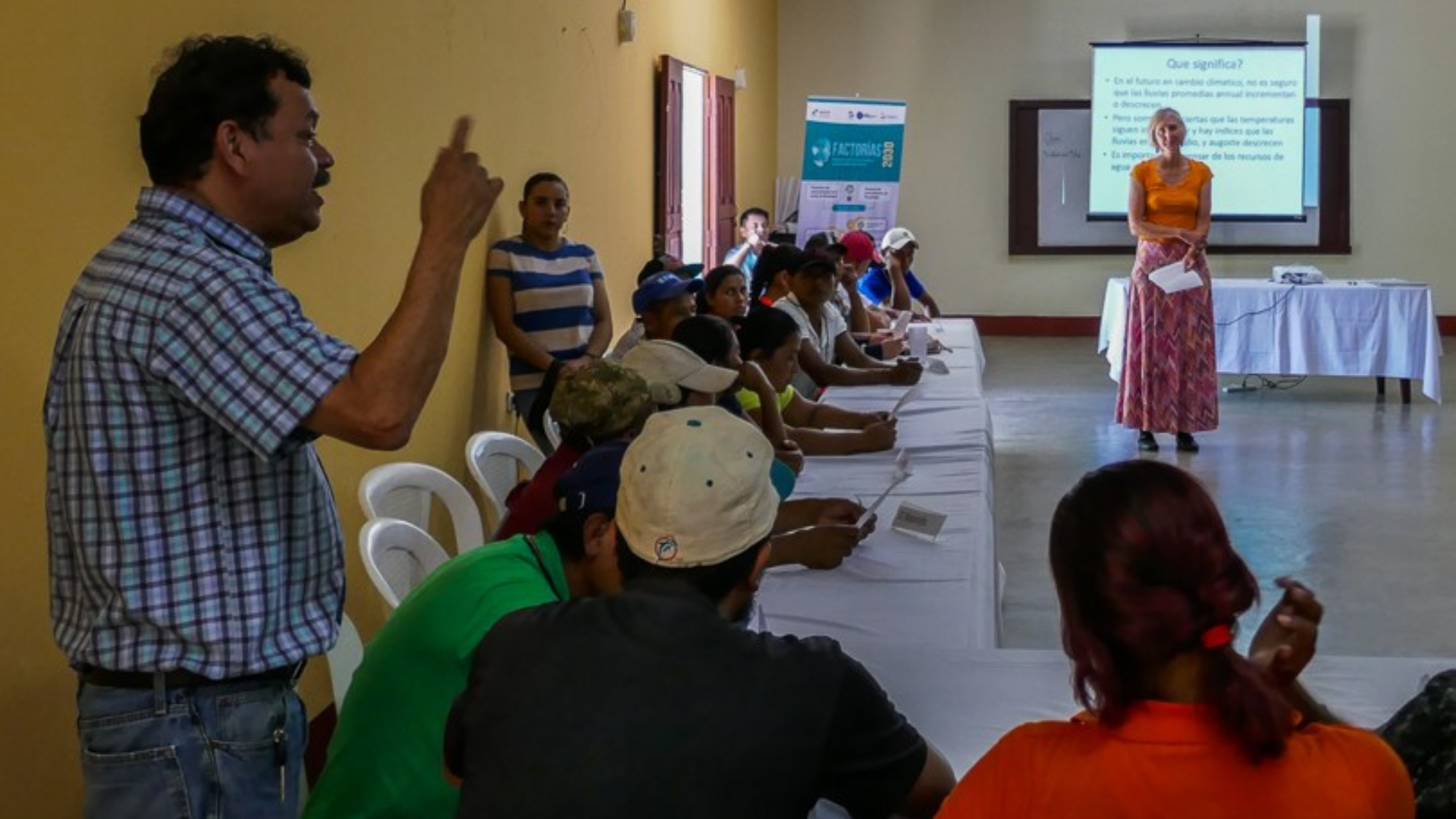
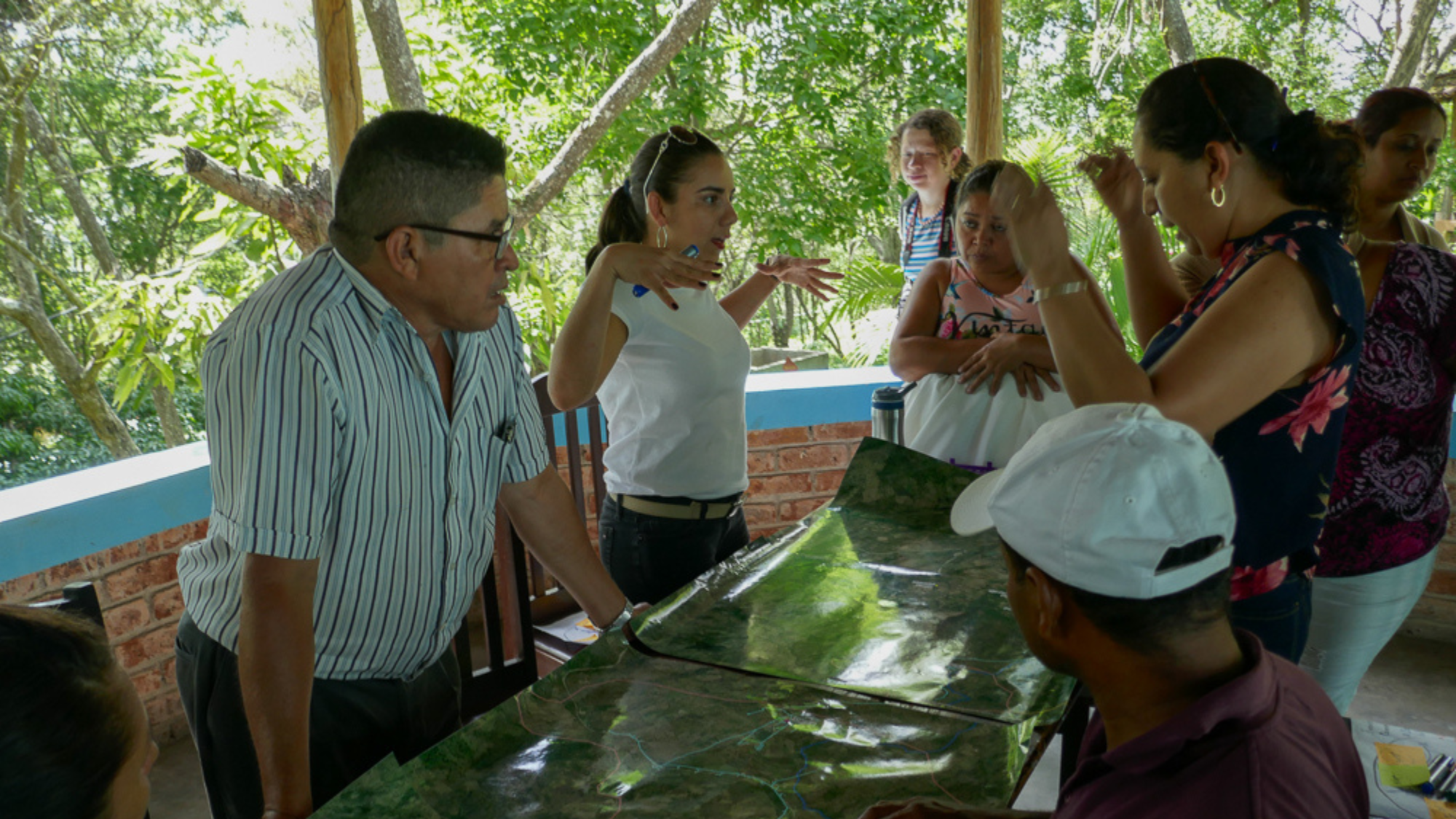
Discussion after the report back on results of climate change analysis. Esteli Workshop, June 2019
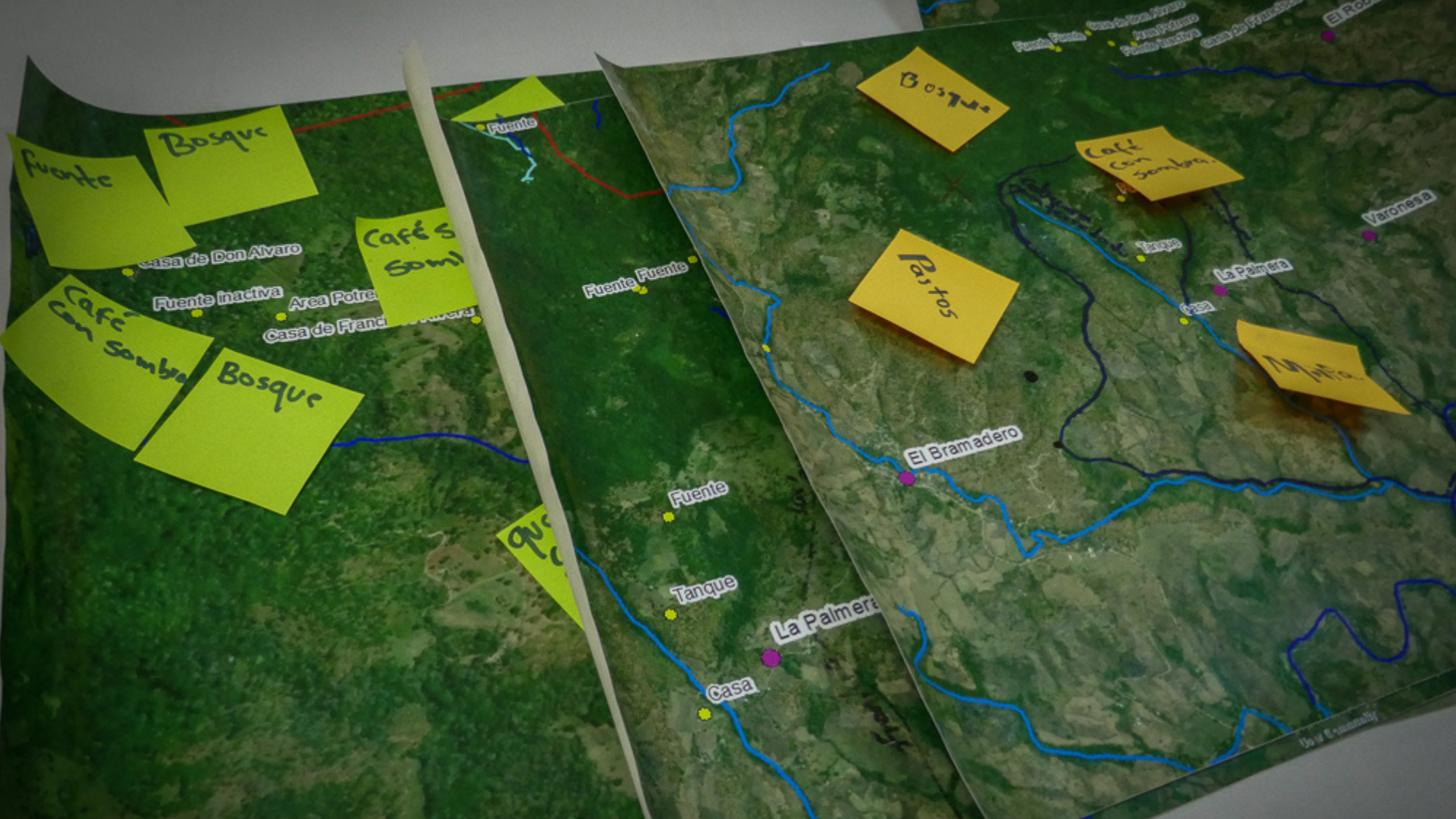
Community maps of streams and fields
Our Approach
Community mapping of water resources, two surveys (2019 and 2023), and several focus groups have helped to document and understand how communities access and manage water in the region and how they perceive their water security and climate preparedness in a group of communities in Northern Nicaragua. Community mapping used large printed aerial maps to have people identify their water sources, often not visible from above in the tropical forests. Water flows were periodically measured in the small streams supplying communities to quantify water resources and document the strongly seasonal cycle. A 2019 survey of Water Committee leaders explored the role of the “CAPS” (Community Water Committees) in managing precious water resources, maintaining water infrastructure, and developing and enforcing norms around water use. A 2023 survey provided information about smallholder experiences regarding access to water and technology, climate information, and preparation for climatic extremes.
Our Results
Smallholder farmers obtain their water from various sources (such as streams, household and community taps connected to a communal water tank, water holes, wells, and rain storage) for various uses (i.e., drinking, cooking, cleaning, bathing, washing, and watering). Smallholder communities of about 600-800 people have constructed their own water infrastructure which involves tapping the springs at higher elevations, storing the water daily in tanks approximately 3m x 3m x 3m, and releasing it to the community, primarily for consumption. The importance of water sources varies in the dry versus wet season. Experiences of water security vary seasonally, it continues to be low for more than 50% of respondents during the end of the dry season (Jan - May). When warned of extreme rains or hurricanes, respondents prepare by delaying planting, buying extra food, reinforcing their houses, adjusting their harvest time, and storing water. All of these require extra resources and time. When information on impending drought is available, respondents prepare by reducing water use, storing water, and planting different crops. Other measures include watering crops more than usual and leaving the fields fallow. Cell phones are an essential component of keeping informed. Many expressed a need for locally-adapted information and knowledge, water technology such as wells and receptacles, as well as a need for consistent and understandable climate forecasts and information on climate change.
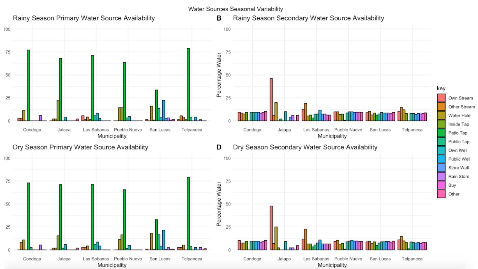
Survey data is from a 2019 survey of water committee members in the Segovias region of northern Nicaragua. A patio tap (often shared) is the primary source of drinking water in communities during both the wet (June - December) and dry seasons (January - May). Shortages are supplemented with other sources, including water from streams, watering holes, wells, rain, or bottled water.
Figure by Iris Stewart-Frey and Andrew Bake '20.
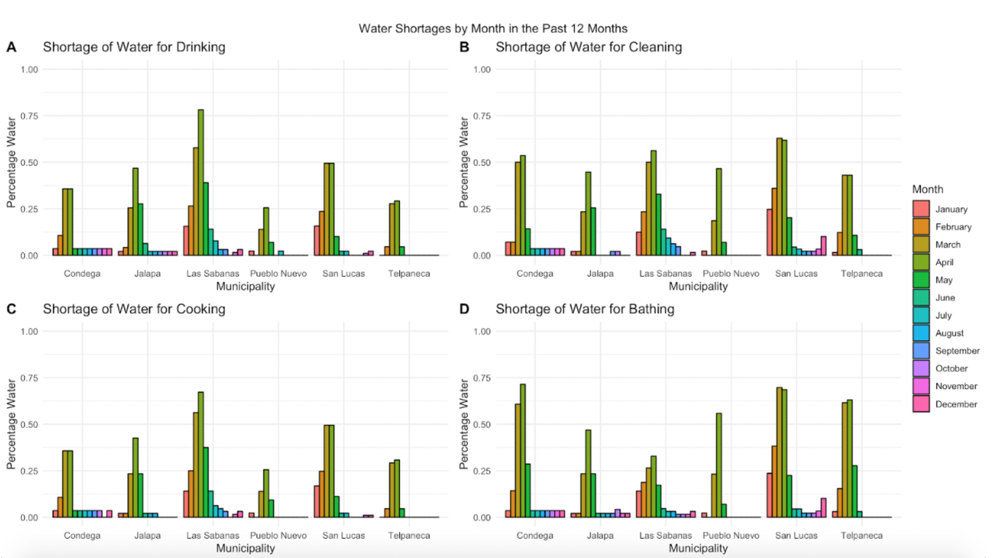
Survey data is from a 2019 survey of water committee members in the Segovias region of northern Nicaragua. During the dry season (January - May) there are widespread shortages of water for essential water uses.
Figure by Iris Stewart-Frey and Andrew Bake ‘20.
Survey data is from a 2022 survey of community members in the Segovias region of northern Nicaragua. ⅔ of respondents face seasonal water shortages.
Figure by Iris Stewart-Frey and Bri Guingona ‘25.
Survey data is from a 2022 survey of community members in the Segovias region of northern Nicaragua. Letting water sit before consumption is used most frequently as water treatment, but would provide the least protection against contamination. Water strategies are not used consistently, and few people purchase purified water.
Figure by Iris Stewart-Frey and Bri Guingona ‘25.
Survey data is from a 2022 survey of smallholder farmers in the Segovias region of northern Nicaragua. When information on impending extreme events is available, respondents prepare by reducing water use, storing water, reinforcing their house, buying extra food, delaying planting, and planting different crops, all of which require extra resources.
Figure by Iris Stewart-Frey and Bri Guingona ‘25.
Survey data is from a 2022 survey of smallholder farmers in the Segovias region of northern Nicaragua. To strengthen the capacity to prepare for extreme climatic events, many respondents expressed a need for (1) locally adapted information and knowledge (2) water technology, such as wells and receptacles, and (3) a need for consistent and understandable climate forecasts.
Figure by Iris Stewart-Frey and Bri Guingona ‘25.